Yukon: Direct Download of OpenStreetMap (OSM) Shapefiles

Download the latest Yukon OSM shapefiles for GIS use. Access .osm.pbf, .shp.zip, and .osm.bz2 formats for accurate mapping and analysis of Yukon's

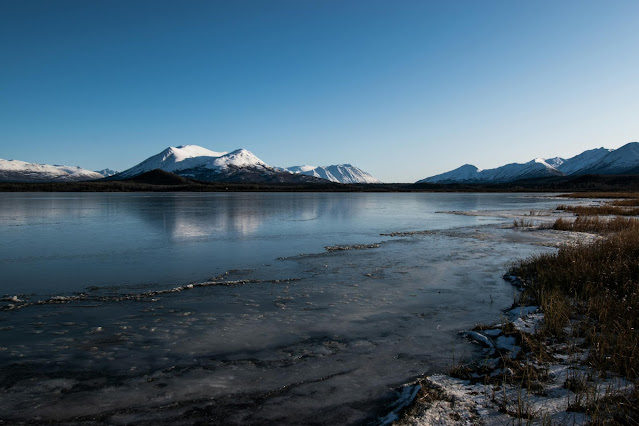
Yukon, located in the northwestern part of Canada, is a territory known for its stunning wilderness, rugged mountains, and rich history linked to the Klondike Gold Rush. While the population is sparse, its vast, untouched landscapes offer tremendous opportunities for exploration, natural resource management, and environmental conservation. The Yukon is also home to diverse wildlife and large national parks like Kluane National Park, a UNESCO World Heritage site. OpenStreetMap (OSM) shapefiles provide accurate and up-to-date geographic data for Yukon, which is essential for infrastructure development, tourism, and environmental monitoring in this remote region.

Body of Water Near Mountain Under Blue Sky


Direct Download of Yukon OSM Shapefiles:

Download the most recent OSM shapefiles for Yukon, Canada:

These files contain detailed geographic information, including roads, rivers, land use, and more, perfect for use in any GIS software.


How to Use Yukon OSM Shapefiles in GIS Software:

  1. Extract the Zip File: Once downloaded, unzip the file to access the shapefiles.
  2. Load into GIS Software: Open the shapefiles in your GIS tool, such as QGIS or ArcGIS.
  3. Start Mapping: Utilize the data to map and analyze road networks, natural resources, and environmental factors.

Why Use OSM Shapefiles for Yukon?

Yukon’s remote and wild landscape makes GIS data highly valuable for various applications, including:

  • Tourism and Adventure Planning: Create maps for trails, campgrounds, and access to wilderness areas, supporting tourism in places like Kluane National Park.
  • Environmental Conservation: Monitor protected areas and wildlife habitats, ensuring that development projects do not harm the natural ecosystem.
  • Natural Resource Management: Plan and monitor mining activities, forestry, and other natural resource extraction projects in Yukon’s vast wilderness.
  • Infrastructure Development: Map out road networks and transportation routes to connect communities and support remote areas.

With its vast wilderness and sparse infrastructure, Yukon requires accurate and up-to-date geographic data for a range of projects. Download the OSM shapefiles for Yukon and get started with mapping and analyzing everything from environmental conservation to resource management. Use the files below to bring your GIS projects in Yukon to life.

Download Yukon OSM Shapefiles Now


License Information

All OpenStreetMap (OSM) data on this site is licensed under the Open Database License (ODbL) 1.0. You are free to use, share, and adapt the data, provided you attribute it as follows:
"Data © OpenStreetMap contributors, licensed under ODbL 1.0."
If you create a derivative database, it must also be shared under the same license.

For full details, visit the ODbL 1.0 license page.

Credit : geofabrik.de

COMMENTS

GIS English

Name

50K,3,Africa,5,Albania,1,Alberta,1,Algeria,1,Asia,4,Atlas,1,Australia,1,Austria,1,Belarus,1,Belgium,1,Bosnia,1,British Columbia,1,Bulgaria,1,Canada,12,Croatia,1,Czech Republic,1,Denmark,1,Download,12,Egypt,1,Estonia,1,Europe,19,FAO,1,Finland,1,France,1,Free,12,Germany,1,Greenland,1,India,1,Indonesia,1,Latvia,1,Lithuania,1,Manitoba,1,Maps,104,Mexico,1,Michelin,1,Morocco,5,North America,71,Norway,1,OpenStreetMap,100,OSM,101,PDF,1,Poland,1,Portugal,1,Puerto Rico,1,Road,1,Saudi Arabia,1,Shapefiles,98,Slovakia,1,Soil,1,Spain,1,Support,1,Sweden,1,Topographic,3,UAE,1,United States of America,54,World,1,Zambia,1,
ltr
item
GeoJamal Maps Hub: Yukon: Direct Download of OpenStreetMap (OSM) Shapefiles
Yukon: Direct Download of OpenStreetMap (OSM) Shapefiles
Download the latest Yukon OSM shapefiles for GIS use. Access .osm.pbf, .shp.zip, and .osm.bz2 formats for accurate mapping and analysis of Yukon's
https://blogger.googleusercontent.com/img/b/R29vZ2xl/AVvXsEgG8ePtI8ItaO4WL2jMuVKNw8WTE1ZaYGn_IBlKHMBJLetbgXMh7p91-nvTCgY4ITa7oiX6IgJaJ5NE216X9keQ9yqEWaYyVIYT5FHWqtSGv-1_cuvo9cgzrsx7Di0kTAxdOB5mY9Fd0NN_TqBugrA5ayUbMocQ_oqRAdcZd0JHSPiSefJCWlbX4RP4dckO/w640-h426/pexels-photo-11546828.jpeg
https://blogger.googleusercontent.com/img/b/R29vZ2xl/AVvXsEgG8ePtI8ItaO4WL2jMuVKNw8WTE1ZaYGn_IBlKHMBJLetbgXMh7p91-nvTCgY4ITa7oiX6IgJaJ5NE216X9keQ9yqEWaYyVIYT5FHWqtSGv-1_cuvo9cgzrsx7Di0kTAxdOB5mY9Fd0NN_TqBugrA5ayUbMocQ_oqRAdcZd0JHSPiSefJCWlbX4RP4dckO/s72-w640-c-h426/pexels-photo-11546828.jpeg
GeoJamal Maps Hub
https://maps.geojamal.com/2024/09/yukon-direct-download-of-openstreetmap.html
https://maps.geojamal.com/
https://maps.geojamal.com/2024/09/yukon-direct-download-of-openstreetmap.html
true
5425003986144260578
UTF-8
Loaded All Posts Not found any posts VIEW ALL Readmore Reply Cancel reply Delete By Home PAGES POSTS View All RECOMMENDED FOR YOU LABEL ARCHIVE SEARCH ALL POSTS Not found any post match with your request Back Home Sunday Monday Tuesday Wednesday Thursday Friday Saturday Sun Mon Tue Wed Thu Fri Sat January February March April May June July August September October November December Jan Feb Mar Apr May Jun Jul Aug Sep Oct Nov Dec just now 1 minute ago $$1$$ minutes ago 1 hour ago $$1$$ hours ago Yesterday $$1$$ days ago $$1$$ weeks ago more than 5 weeks ago Followers Follow THIS PREMIUM CONTENT IS LOCKED STEP 1: Share to a social network STEP 2: Click the link on your social network Copy All Code Select All Code All codes were copied to your clipboard Can not copy the codes / texts, please press [CTRL]+[C] (or CMD+C with Mac) to copy Table of Content